Source for the North
www.fishweb.com
Pictured Rocks
National Lakeshore
Alger Co. Michigan
click red on the map
for more information
Central U.P. Lodging
Munising Weather
»
Shorline Photo Tour
«
PHOTO PAGES:
Au Sable Point Light
Beaver Creek
Chapel Rock
Grand Island, East
Grand Marais Harbor
Grand Portal Point
Grand Sable Dunes
Grand Sable Lake
Indian Head Rock
Legion Lake
The Log Slide
Miners Castle
Miners Falls
Mosquito River
Munising Falls
Munising, South Bay
Pictured Rocks
Sable Falls
Sable River
Sail Rock
Spray Falls
Shoreline Cavern
Shoreline Cove 1
Shoreline Cove 2
Sullivan Creek
Shoreline Springs
Trappers Lake
Twelvemile Beach
LAKE MAPS:
Beaver Lake
Grand Sable Lake
Legion Lake
Trappers Lake
»
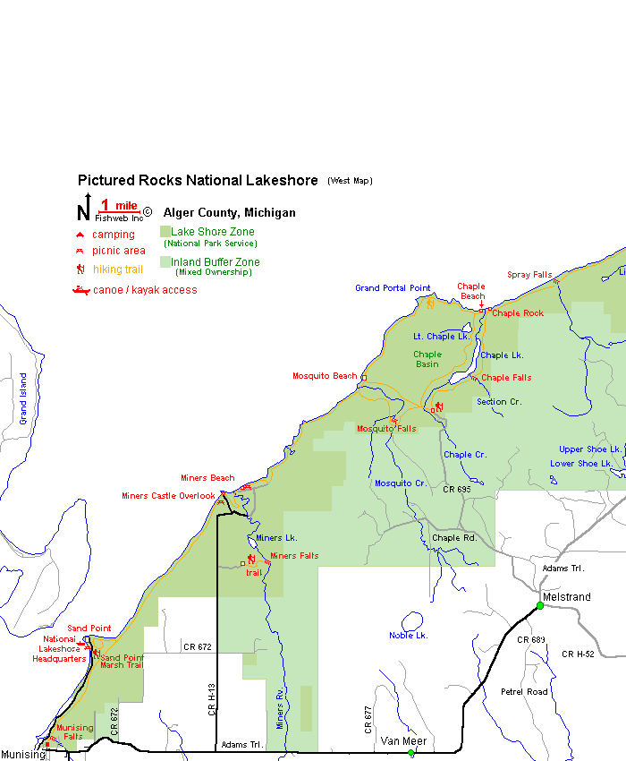
PRINT MAP (west)
«
»
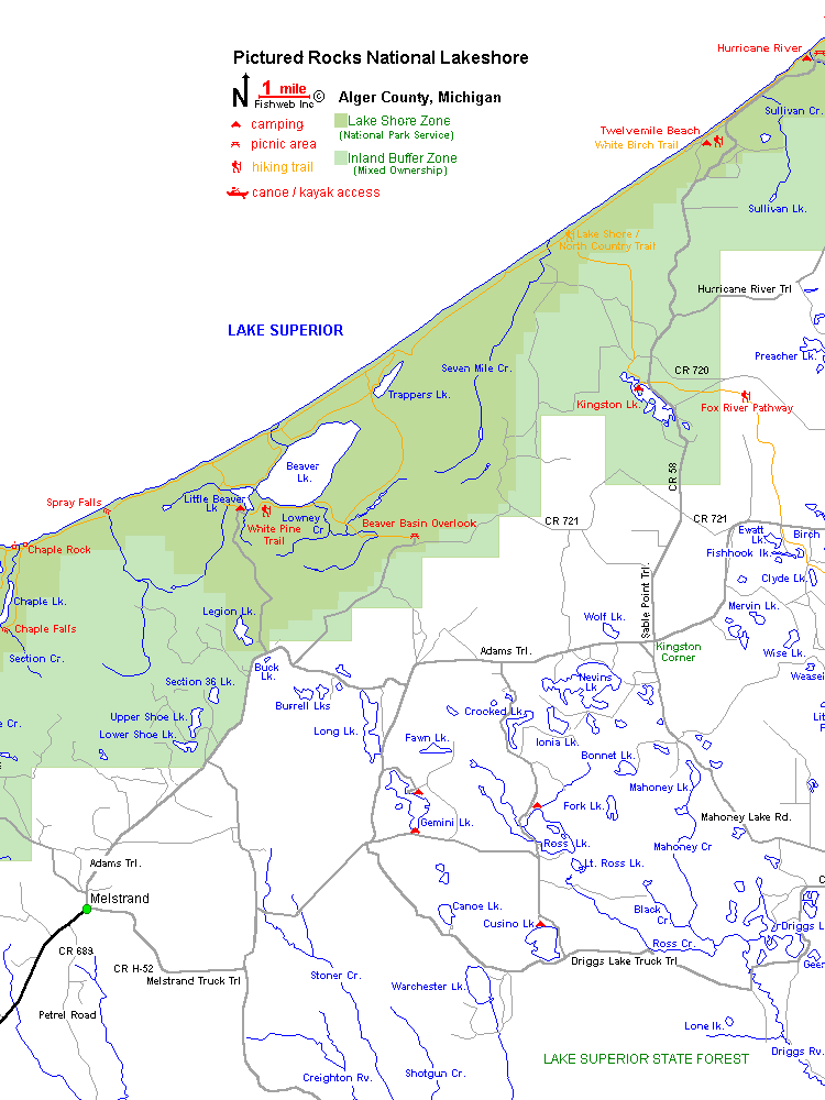
PRINT MAP (center)
«
»
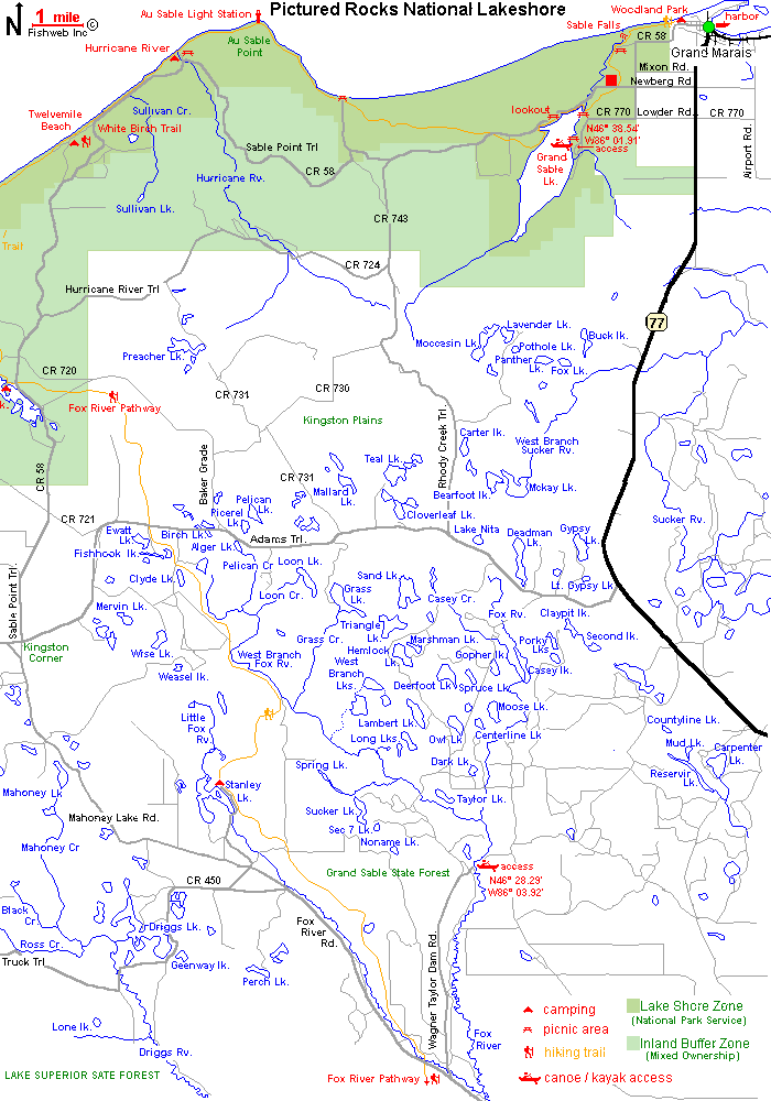
PRINT MAP (east)
«

