Source for the North
www.fishweb.com
Iargo Springs parking:
Latitude: N 44° 26.441'
Longitude: W 83° 40.546'

River Road National
Forest Scenic Byway
Au Sable River Map
Iosco County Map
Oscoda Michigan
Oscoda Weather


|
Iargo Springs - Au Sable River - Iosco County - Oscoda MI.
River Road National Forest Scenic Byway - Michigan Interactive™
|
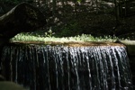
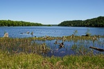
Just off of River Road National Scenic Byway, Iargo Springs provides a panoramic view of the Au Sable
River. Used as a drinking water source since pre-settlement times, dams were constructed on the springs
by early loggers before the turn of the century. The dams were useful in diverting water to the logging
camps nearby. Most of Cooke Pond was dry land then.
|
|
Europeans have visited the springs for recreation since the 1920s. A trail to the springs was constructed
by the Civilian Conservation Corps in 1934. Early photographs show the dam being repaired and reinforced
by the CCC's. The dams lasted until 1981 when a storm took them out. The site was renovated in 1991.
Steps were added and boardwalks along the springs, as well as the dams being rebuilt.
|
|
M.I. Advertisement Pricing
|